
Page 11 - Alderville First Nation
P. 11
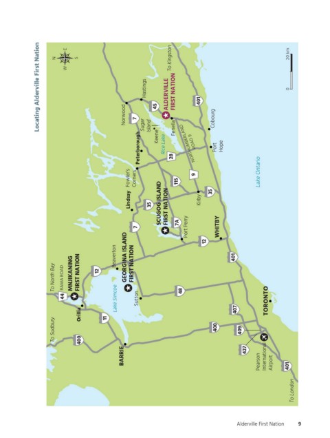
Locating Alderville First Nation  N  E  W  S  Norwood  Hastings  45  ALDERVILLE  To Kingston FIRST NATION  401  20 km  0


                                                       Peterborough 7  Sugar  Island  Keene  Rice Lake  28  Fenella  NORTHUMBERLAND  ROAD 9  Cobourg  Port  Hope


                                                    Fowler’s  Corners  115  9                    Lake Ontario


                                                    Lindsay  35  SCUGOG ISLAND  FIRST NATION  Kirby  35


                                                       7             7A  Port Perry  12  WHITBY                       Not enough room to show signs for both Highway 35 and 115 south of Kirby, so only 35 is shown


                          To North Bay  RAMA ROAD  MNJIKANING  FIRST NATION  12  Beaverton  GEORGINA ISLAND  FIRST NATION  401  Highway 28 north of Port Hope is a county road, not a King’s Highway


                              44                Lake Simcoe  Sutton   48                            TORONTO       Map to be placed vertically, rotated 90°

                                   Orillia  11                                           407
                          To Sudbury  400                                         400      409


                                                  BARRIE                                    427  Pearson  International  Airport  401


                                                                                                            To London  OGEMAWAHJ COMMUNITY BOOKS  otccb_afn_f02  Michael Borop  2nd pass


                                                                                         Alderville First Nation  9    Figure Number  Creative  Pass  Approved  Not Approved


          ogemawahj_community_book3.indd   9                                                                2019-02-28   10:57 AM