
Page 46 - Moose Deer Point First Nation
P. 46
Transportation
To get to Moose Deer Point, we follow Twelve Mile Bay Road
down a narrow natural inlet to its point, which we call our home.
This road, which was built in the early 1960s, is the only road to
our community. Although many of our members use boats to
travel on water, the road is our main route of transportation.
Our First Nation is quite isolated. There are very, very few homes
or driveways along the way. We tell people to drive all the way
down Twelve Mile Bay Road, and to keep going when they think
they have gone too far or are lost. The 25- to 30-minute journey
down the road is always a longer drive than newcomers expect!
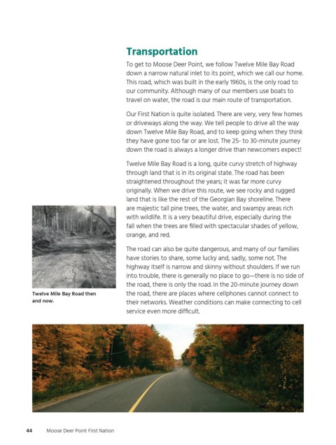
Twelve Mile Bay Road is a long, quite curvy stretch of highway
through land that is in its original state. The road has been
straightened throughout the years; it was far more curvy
originally. When we drive this route, we see rocky and rugged
land that is like the rest of the Georgian Bay shoreline. There
are majestic tall pine trees, the water, and swampy areas rich
with wildlife. It is a very beautiful drive, especially during the
fall when the trees are filled with spectacular shades of yellow,
orange, and red.
The road can also be quite dangerous, and many of our families
have stories to share, some lucky and, sadly, some not. The
highway itself is narrow and skinny without shoulders. If we run
into trouble, there is generally no place to go—there is no side of
the road, there is only the road. In the 20-minute journey down
Twelve Mile Bay Road then the road, there are places where cellphones cannot connect to
and now. their networks. Weather conditions can make connecting to cell
service even more difficult.
44 Moose Deer Point First Nation
ogemawahj_community_book6.indd 44 2019-02-27 11:44 AM